Hierve El Agua Ancient Canals
EXPERIENCE
The Zapotec Pipeline: Uncovering the Ancient Canals of Hierve El Agua
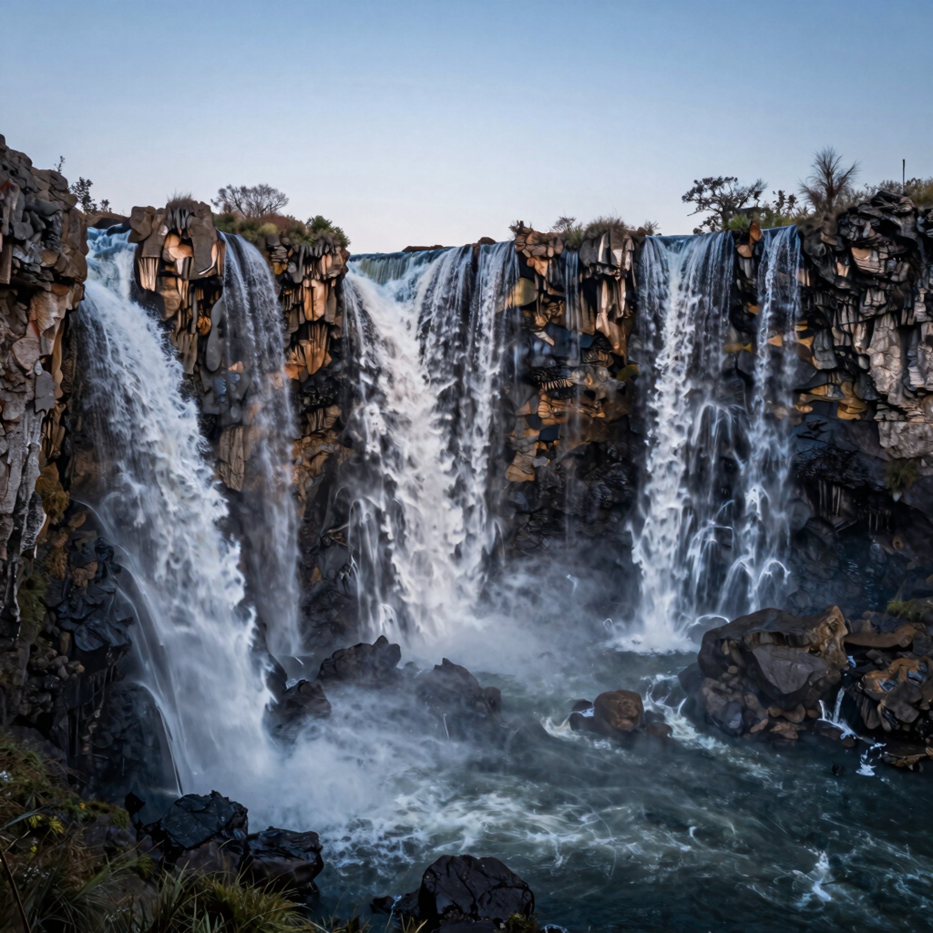
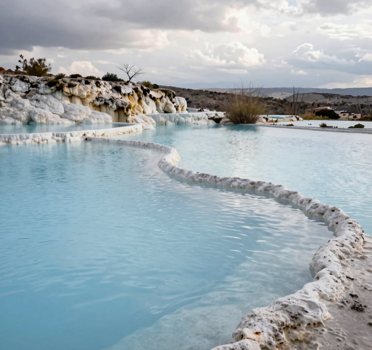
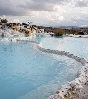
Most visitors to Hierve El Agua come for the "infinity pool" selfie, but if you look down—literally at your feet—you’ll find a far more impressive feat of human ingenuity. Thousands of years before modern engineering reached the Sierra Norte, the Zapotec people were already master hydrologists.
As a journalist who has spent hours tracing these limestone grooves under the Oaxacan sun, I can tell you that the Ancient Canals of Hierve El Agua are the site’s true "hidden" marvel. While the waterfalls are a natural wonder, the canal system is a testament to survival in one of Mexico’s most arid highlands.
A 2,500-Year-Old Irrigation Masterpiece
Hierve El Agua isn't just a scenic overlook; it is one of the most complete pre-Hispanic terraced irrigation sites in Mesoamerica. Archeological research, most notably by James A. Neely, suggests this system was in active use from roughly 700 BCE until 1300 CE.
How the System Worked
The Zapotec didn't just wait for rain. They engineered the landscape to "harvest" the mineral-rich springs.
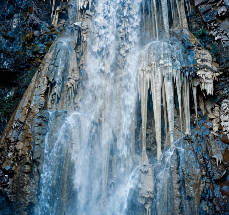
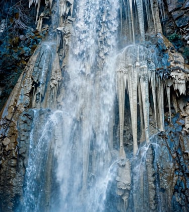
The Source: Water emerges from the mountain at the "Amphitheater" plateau.
The Capture: Ancient engineers carved narrow channels directly into the travertine rock. Because the water is so heavy with calcium carbonate, these canals eventually "self-sealed" and became petrified, preserving them perfectly for two millennia.
The Gravity Feed: Using the natural 50-to-90-meter drop of the cliffs, the canals funneled water down to man-made terraces on the valley floor, allowing for year-round agriculture in a region that sees almost no rain for six months of the year.
[Image showing a close-up of a calcified canal groove alongside a modern stone path]
Where to Find the Canals Today
You don't need an archeology degree to see them, but you do need to know where to look. In 2026, most of the best-preserved canals are located just below the main swimming area.
1. The Amphitheater Vents
Right near the "boiling" springs at the top, look for geometric grooves in the rock. Unlike the natural erosion ripples, these canals are remarkably straight and uniform. They were designed to guide the bubbling water away from the springs before it could evaporate and clog the source.
2. The Lower Terraces
If you take the Loop Trail (the steep hike that leads to the base of the falls), stop halfway down. You will see flat, shelf-like structures built into the hillside. These are the ancient agricultural terraces. If you look closely at the cliff walls above them, you can still see the white "scars" of the canals that once delivered water to the corn and squash fields below.
3. The Salt Works
Some historians believe the canals served a dual purpose: Salt Production. By diverting the highly mineralized water into shallow, flat pans, the Zapotec could evaporate the water and harvest the salt—a precious commodity for trade in ancient Monte Albán.
Boots-on-the-Ground Tips for 2026
Don't Step on the History: While the canals are made of stone, they are fragile. Please walk on the designated dirt paths or the broad travertine flats, rather than inside the ancient grooves.
Look for the "Tecuates": This is the local term for the calcified pipes. They look like gray or white stone tubes.
Hire a Local Guide: At the entrance, you can hire a guide for about 400 MXN. Ask specifically for a "geology and history" tour. They will point out canal segments that are completely invisible to the untrained eye.
The Morning Shadow: Visit early (8:30 AM). The low-angle sun creates shadows that make the shallow relief of the canals pop, making them much easier to photograph.
FAQ: The History and Archeology
1. Were the canals used for drinking water? Probably not. The high sulfur and mineral content makes the water a natural laxative. It was almost exclusively used for irrigation and salt minerals.
2. Is Hierve El Agua a sacred site? Yes. Archeologists believe the Zapotec viewed the springs as a portal to the underworld, making the canals both a practical tool and a ritual pathway for "sacred water."
3. Are there similar canals elsewhere in Mexico? Very few. Most ancient wood or clay irrigation systems have rotted away. Hierve El Agua is unique because the water literally turned the canals into stone.
4. How long is the canal system? The documented network extends for several kilometers across the hillsides, though only the sections near the waterfalls are easily accessible to tourists.
5. Why was the site abandoned in 1300 CE? The exact reason is unknown, but theories include a massive drought, a shift in trade routes, or the rising power of neighboring Mixtec groups.
6. Can I see the canals in the rainy season? Yes, but they may be covered in a thin layer of mud. The dry season (Nov–May) is best for spotting the crisp edges of the stone carvings.
7. Did the Zapotec build the pools? No. The large "infinity pools" are modern additions for tourism. The Zapotec used much smaller, natural catch-basins.
8. Are the canals protected by the government? The site is managed by the local ejido (community), but it is recognized as an important archeological zone by INAH (National Institute of Anthropology and History).
9. Can I take photos of the canals? Yes, but drones may require a specific permit from the local authorities at the gate.
10. How deep are the canals? Most are only 10–20 centimeters deep. They were designed for constant, slow flow rather than high-volume transport.
11. Is there an museum on site? No, but the ruins of Mitla (just 45 minutes away) provide excellent context for Zapotec engineering.
12. Did they use tools to carve the rock? Yes, they used harder stone tools (like basalt or obsidian) to peck and grind the channels into the softer travertine.
13. Are the canals still "working"? In a way, yes. Water still flows through some of the ancient channels, though it no longer reaches the agricultural terraces.
14. Can I walk the full length of the canals? No, many sections are on steep, unstable cliffs. Stick to the marked "Sendero de las Cascadas" trail.
15. Is it worth visiting if I'm not a history buff? Absolutely. Even if you don't care about irrigation, the geometric patterns the canals create against the wild mountain backdrop are stunning.
Connect with Oaxaca's Living History
Standing over these canals, you realize that Hierve El Agua isn't just a place to swim—it’s a monument to human persistence. The Zapotec didn't just survive this harsh landscape; they carved their legacy into it.


HIERVE EL AGUA
© HierveElAgua.org - 2026.
This website is an independent guide created by nature enthusiasts and local Oaxaca experts. Please note that this is not the official website by the Oaxaca Municipality. Our mission is to provide high-quality information, historical context, and logistical support for visitors visiting Hierve El Agua nature wonder.
We take pride in only recommending and selling 100% official and authorized tickets sourced through licensed primary and secondary providers. By booking through our links, you ensure a valid, easy entry into the site. To support our local research and the maintenance of this guide, we may earn a small affiliate commission from your purchase.